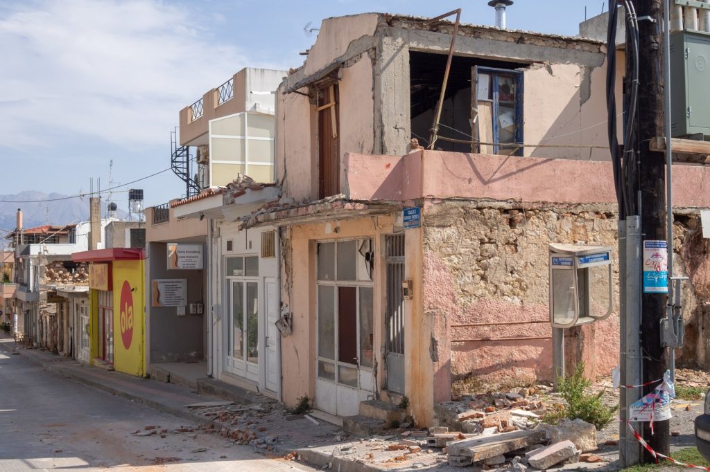
When a major earthquake struck a region with already fragile infrastructure, rescue crews faced the familiar challenge of locating survivors amid the rubble. The difference this time is a new layer of technology operating from orbit. Space agencies, technology firms, and international bodies are now feeding satellite imagery through artificial intelligence systems to produce rapid damage maps.
The core objective: direct rescue teams to the hardest-hit areas as quickly as possible. Traditional damage assessment relies on human analysts carefully examining satellite photos, a process that can take days.
AI models can accomplish the same task in hours, flagging collapsed structures, blocked roads, and displaced populations. The speed of this analysis represents a meaningful shift in emergency response capability.
How the AI-Satellite Pipeline Works
The system follows a straightforward sequence. Satellites pass over the affected region, capturing high-resolution optical and radar imagery.
That data streams into AI models trained to recognize the visual signatures of earthquake damage: pancaked buildings, debris fields, and changes in road networks. The models then output maps that prioritize zones for search-and-rescue teams. The objective is simple, but the execution depends on a chain of coordinated assets and expertise.
NASA, Microsoft, and the European Union are among the organizations involved in this effort. NASA contributes its Earth-observing satellite infrastructure and decades of remote sensing expertise.
Microsoft provides cloud computing power and AI model training. The European Union offers coordination frameworks and funding mechanisms that link space assets to local responders. Each partner brings a distinct piece needed for the whole system to function.
One observer notes that the same kind of AI tools used to help a drone navigate a warehouse or recommend a film are now being pointed at disaster zones. The stakes, however, are dramatically different.
A false positive in a recommendation algorithm means a bad movie choice. A false positive in a damage map means wasted hours for rescue teams who cannot afford them. The margin for error is narrow, which is why training the models on accurate damage signatures is essential.
A Legacy of Earth Observation Now Applied to Lifesaving Speed
NASA’s role in this effort builds on a long history. The agency was created in 1958 to give the nation’s space efforts a peaceful, civilian orientation during the Cold War space race. From the start, its mission went beyond putting humans in orbit.
It was conceived as a vehicle for scientific discovery and practical applications on Earth. Over the decades, NASA’s portfolio expanded beyond the Apollo Moon landings, including the Space Shuttle, the International Space Station, and now the international Artemis program aimed at returning astronauts to the lunar surface.
Alongside human spaceflight, the agency has invested heavily in Earth science. Through programs such as the Earth Observing System, NASA operates a constellation of satellites that monitor weather, climate, land use, and natural hazards. These spacecraft generate vast streams of data on everything from forest fires to hurricanes.
The same satellite infrastructure designed for climate science and exploration is now being repurposed for life-saving speed. When an earthquake strikes, NASA’s Earth-observing satellites can capture high-resolution imagery of the affected area within hours.
Feeding that data into AI models trained to recognize damage patterns allows responders to see collapsed buildings and blocked roads far faster than human analysts could. The technology itself is not new. The speed at which it now operates is.
The agency that helped put a man on the Moon is now helping rescue crews find the quickest path through a disaster zone.
Last-Mile Challenges and the Path Forward
As ever, the bottleneck is not the technology itself but what responders call the last mile: getting those maps into the hands of crews who may lack reliable internet or power. The quake struck a region where infrastructure was already fragile. Ground-based sensors may be destroyed or offline.
Communications networks may fail. But satellites keep transmitting, and AI keeps processing, as long as the cloud servers stay powered.
This makes the satellite-plus-AI pipeline particularly valuable in scenarios where on-the-ground infrastructure is compromised. Looking ahead, what to watch next is whether these organizations formalize the ad-hoc collaborations that have emerged during this response. A standing framework, rather than a scramble after each disaster, would represent a genuine leap forward in disaster response capability.
For now, the focus remains on the current operation: getting the maps right, getting them out fast, and getting rescue teams to the people who need them. The work proceeds from orbit down to the rubble-strewn streets, with lives depending on how quickly the data can travel that distance.
{“@context”: “https://schema.org”, “@type”: “NewsArticle”, “headline”: “AI satellites speed earthquake rescue with rapid damage maps”, “description”: “CARACAS, July 2 — When a major earthquake struck a region with already fragile infrastructure, rescue crews faced the familiar challenge of locating survivors amid…”, “datePublished”: “2026-07-02T09:30:00+00:00”, “author”: {“@type”: “Person”, “name”: “Arjun Mehta”}, “publisher”: {“@type”: “Organization”, “name”: “InfoPulse Today”, “url”: “https://newsfeed.infopulsetoday.com/”}}